In Great Britain, the lines of sensitivity on which many sacred constructions are set out across, are generally termed 'Ley Lines';
and the subtle energies found along them, either 'Earth' or simply 'Ley' energy;
As might be expected, one will find different names for this subject around the planet; for example, ...in China, they may refer to the energy as 'Chi',
(which basically means a beneficial, health-giving life force, ...a normal, but little understood part of nature),
while the Aborigines of Australia have dubbed the lines as 'Song Lines',
using just natural features in the environment as their markers. Historically, it appears to have been an unwritten rule, (a secret code), amongst many Town Planners/Masons etc, that these flows had to be commemorated by erecting special building works.
The exact reasons why this should be so have been lost in the mists of time; but a logical answer would be that this was
all laid out for us, in order that disciples present and future, could confirm and celebrate where the best energies could be found.
Dowsing methods were often employed to locate prime land which enjoyed streams of Positive Earth Energy; in addition, (as astonishing as this may come across), several researchers including ourselves, think it likely that, through it's energies, the Ley system may have even subconsciously impelled people to construct buildings at certain favorable spots -
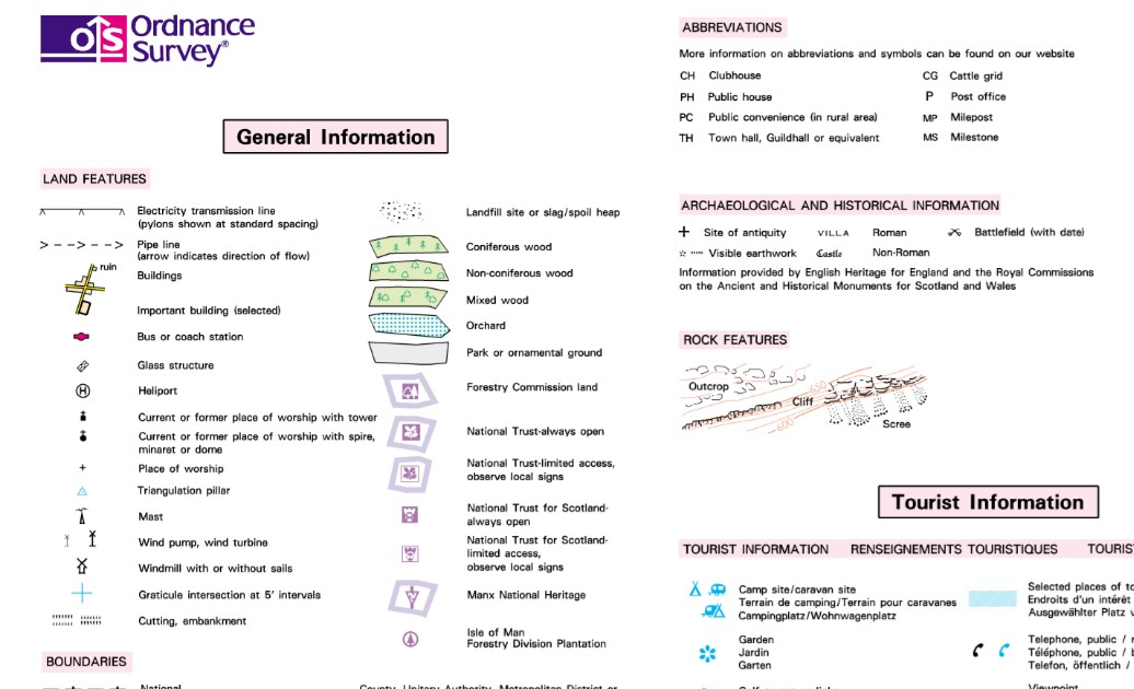
by somehow triggering the subtle perception ability that we all have, more commonly called The Sixth Sense. Exactly where Ley's exist, or once existed, (as many have been badly damaged through modern living), is easily identified using an Ordnance Survey map, preferably The Landranger series 1:25,000 scale.Look for alignments of 5 or more Churches, Chapels, Shrines, Earthworks, Mounds, Megaltihic Sites/Single Stones, Castle Ruins... each spaced a good distance apart, and in any combination.
More contemporary places of worship can also come into consideration when Ley hunting, as many were built on previous constructions,
(early earthworks and other pagan sites), as quite a few Castles were also.
Please don't neglect points simply marked 'Well', they could be important markers, as water sources were revered anciently.

'Motte and Bailey' systems shouldn't be ignored either.
Distance spans of Ley Lines vary consderably; some may only be between 1 and 4 miles, ...while others might go right off the map! And they don't always have to be gun barrel straight by any means,...many are found to have the odd 'kink' or bulge here and there, along the way.
OS Symbol chart for your convenience 
Next, walk at least some of your discovered line if you are able:'Ley' is a gentle energy, often barely detectable on scientific gadgets, but far better confirmed using Dowsing Rods,and can travel Overground or Through the ground, and is thought to be Geologically-Generated in origin. 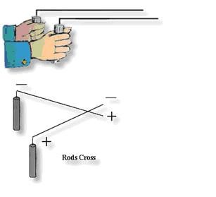
'L-Shapes' like these are easily available on the internet. See if you can get your dowsing rods to react. Also the study of Place Names can assist further,but please click this link first, as there are lots of pitfalls one can encounter when researching.
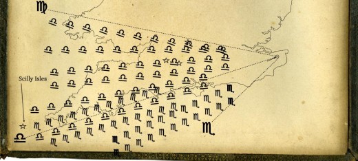
Anciently, Ley lines were mapped nationwide, as in this example